
Filter Results:
Category: Aerial
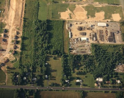
Aerial view of the Department of Public Works, 1970's. Latta Road in foreground.
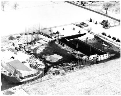
Department of Public Works, Long Pond Road, 1940s.
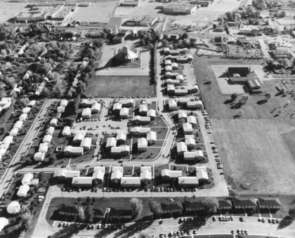
Aerial view of Cardinal Mooney High School looking north. Olympia High School athletic fields are on the lower left. Cardinal Mooney was a Catholic high school that opened in 1962 and closed in 1989. The Olympia Drive and Rhea Crescent neighborhood is located adjacent to the baseball fields.
Aerial view of Bonesteel, McCall and Stone Roads looking SE, 1960's.
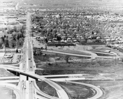
An aerial view of the Route 47, prior to becoming 390 North, under construction in 1968. The portion of 390 North from Route 104 to the Lake Ontario State Parkway was designated "Assemblyman Roger J. Robach Memorial Lakeway" in 1992.
Aerial view of the Department of Public Works looking east.
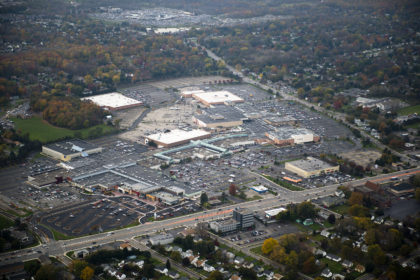
The Mall at Greece Ridge looking south. The Mall at Greece Ridge began its history as two separate malls. Greece Towne Mall opened in 1967 and Long Ridge Mall opened in 1969. The two malls merged in 1994.
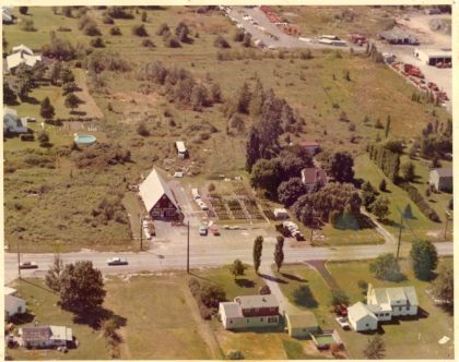
Agway Garden Store located just north of Latta Road at 675 Long Pond Road, 1970's. It relocated to 870 Long Pond in the 1990's at the former Matts Garden Center loation, after which it subsequently closed a few years later.
Aerial view of Ridge Road looking south. St. John's Church in the center. Long Ridge and Greece Town Malls in the distance. 1970's.
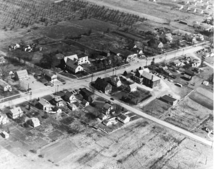
Ridge Road, 1940s, looking NE, including Buckman's Dairy. Grange Hall is visible on the south east corner of Long Pond and Ridge Roads. The old Greece Town Hall is visible just right of center.
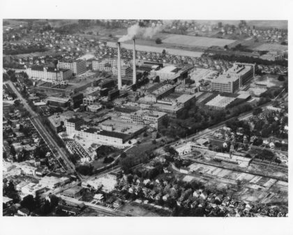
Kodak Park on Ridge Road and Lake Avenue, 1923.