Image ID:1987
Description:
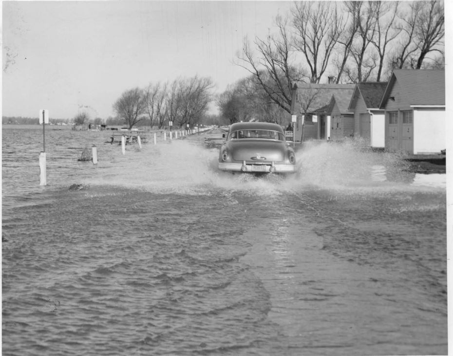
Flooding along Edgemere Drive, 1952. Water levels were thirty inches above normal. Property owners along the shore blamed the use of Gut Dam, a Canadian installation in the St. Lawrence River, to control the water levels.
Flooding along Edgemere Drive, 1952. Water levels were thirty inches above normal. Property owners along the shore blamed the use of Gut Dam, a Canadian installation in the St. Lawrence River, to control the water levels.
Location:Greece, New York
Date:1952
Source:Office of the Town Historian
Categories:
Weather
Views:1521 Views
Date Added:June 25, 2019
Full Image: 930 x 731px
Large Image: 930 x 731px
Medium Image: 420 x 330px


