

Image ID:1796
Description:
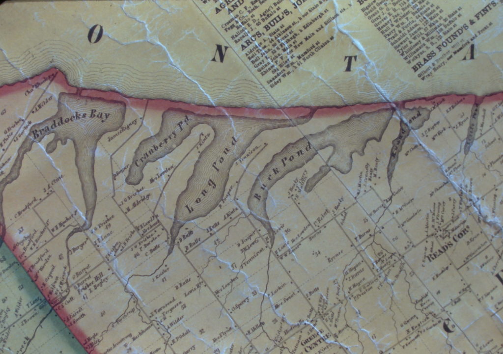
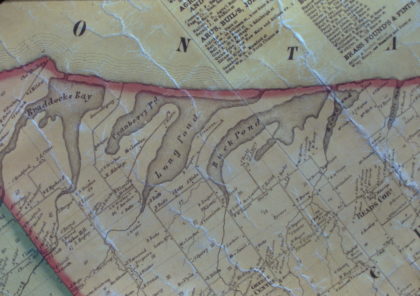
1850's map of the ponds that are located along the shore of Lake Ontario; including Braddock Bay, Cranberry Pond, Long Pond, Buck Pond and Round Pond, 1850's.
1850's map of the ponds that are located along the shore of Lake Ontario; including Braddock Bay, Cranberry Pond, Long Pond, Buck Pond and Round Pond, 1850's.
Location:Greece, New York
Date:1855
Source:Office of the Town Historian
Views:3619 Views
Date Added:February 15, 2019
Full Image: 5427 x 3823px
Large Image: 1024 x 721px
Medium Image: 420 x 296px