
Filter Results:
Category: Roads & Maps
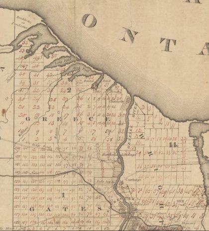
Map of Greece, 1820.
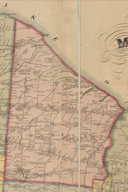
Map of West Greece, 1852 from Gillette Publishing and P.J. Browne surveying.
Town of Greece Lathrop plat map of Town of Greece, 1902.
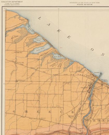
U.S. Geological Survey topography map of Greece, 1893.
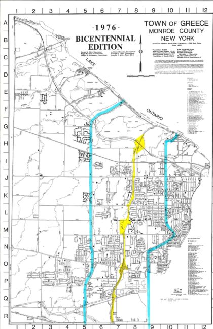
Town of Greece map, bicentennial edition, 1976. Greece had a population of 85,000 at the time and about 300 miles of roads covering almost 42 square miles.
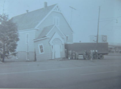
A truck veered off Ridge Road on the morning of January 6, 1955 and crashed into the Greece Grange Hall. The truck was carrying 800 crates of apples when it side-swiped a vehicle before crashing into the building. There were no serious injuries. The driver of the truck, Paul Stauver, reported that the brakes failed and he was unable to control the vehicle.

The marketing map promoting the Dewey Avenue Tract subdivision built by Edwards Realty Company, 1923. There were over nine hundred lots available and it boasted over a thousand trees. Eight hundred and fifty six of the lots were available for one dollar a week, no interest and no property taxes for the first two years.
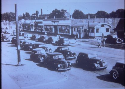
The SE corner of Ridge Road and Dewey Avenue, 1930's. The Wegmans can be seen in the center, which was located at 409 West Ridge Road. This Wegmans location was promoted as having "neighborhood convenience with all of the advantages of downtown variety and low prices."
1858 map of South Greece, Gillette's map of Monroe Co., New York
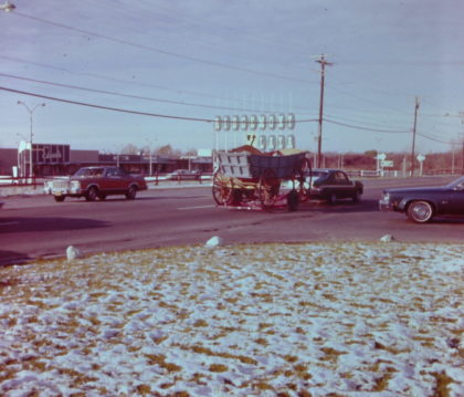
The corner of Ridge Road and Pepperidge Drive, across from Ridgemont Plaza, 1976. Ridgemont Plaza opened on the morning of 17 July 1959. Pictured in the foreground is the Conestoga wagon that was used for a bicentennial event at Greece Towne Mall.
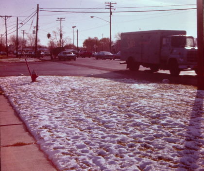
The corners of West Ridge and Corona Roads looking west, 1979. The Holiday Inn can be seen just beyond the gas station. The hotel, located at 1525 West Ridge Road, was the scene of a terrible arson fire on 26 November 1978 that resulted in 10 deaths. The crime was never solved.
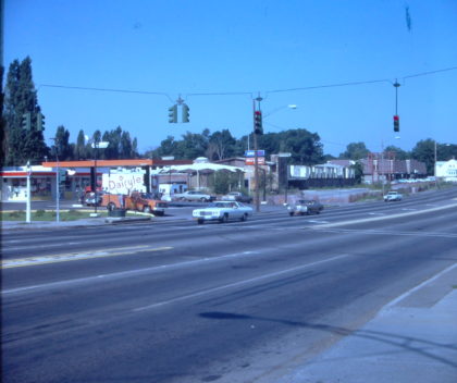
Corner of Ridge Road and Fairmont Avenue looking east, 1976.
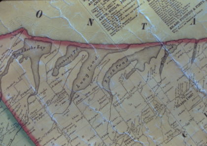
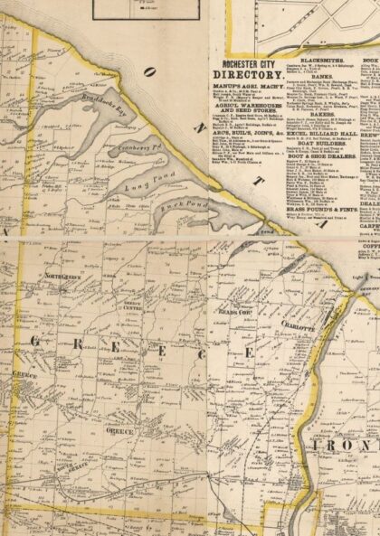
1850's map of the ponds that are located along the shore of Lake Ontario; including Braddock Bay, Cranberry Pond, Long Pond, Buck Pond and Round Pond, 1850's.
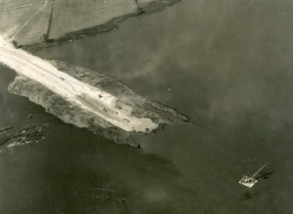
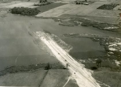
Construction of the expanded Lake Ontario State Parkway, 1940's. It was initially a two mile long gravel road building by the PWA in 1935 that ran through Hamlin Beach Park. The Parkway is now 35 miles long and runs along the shores of Lake Ontario. Initial funding was secured in 1937 and construction began in the 1940's. Additional extensions were added through the early 1970's.
Construction of the expanded Lake Ontario State Parkway, 1940's. It was initially a two mile long gravel road building by the PWA in 1935 that ran through Hamlin Beach Park. The Parkway is now 35 miles long and runs along the shores of Lake Ontario. Initial funding was secured in 1937 and construction began in the 1940's. Additional extensions were added through the early 1970's.