
Filter Results:
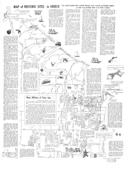
1967 illustrated map titled "Map of Historic Sites in Greece" with historical overview of the history of the Town of Greece. Also features notable landmarks and events spanning centuries, beginning with early Native American campsites from the 1600s and British military activity in 1789, followed by pioneer settlements in the 1790s. The map highlights transportation milestones such as the Old Ridge Road—once traveled by ox carts, stagecoaches, and covered wagons—and the Old Trolley Line, which operated from 1891 to 1925. Recreational and cultural sites like the Old Manitou Beach Amusement Park and Little Coney Island in nearby Webster (1880–1919) are also depicted, alongside significant community institutions such as the Mother of Sorrows Church, established in 1839, and Kodak Park, founded in 1890. Includes geographical information, as well.
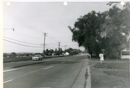
The corner of West Ridge Road and Pepperidge Drive looking west. This is the future site of Ridgemont Plaza, 1955. In 2021, Denny's Restaurant sits on the corner of Pepperidge and Ridge Road just beyond the Rt 104 sign.
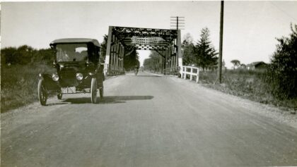
A view of the steel bridge over the Barge Canal at Elmgrove Road, 1919. The bridge was the site of numerous car accidents and drownings over the years. By 1967, it was deemed "unbelievably rickety and dangerous" and an "incredible carry over from the horse and buggy era." It was replaced in 1971.
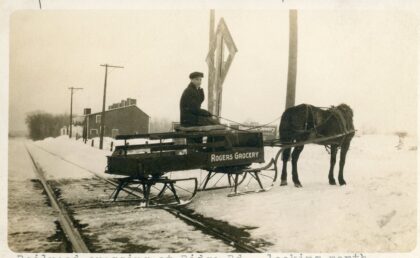
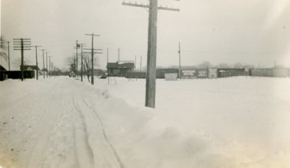
A Roger's Grocery delivery boy crosses the tracks at Ridge Road, looking north. Roger's Grocery was located at 1458 Dewey Avenue (near Ridgeway) and was owned by Frank Rogers. 1900's.
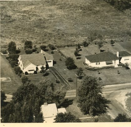
Aerial view of 131 & 135 Elmgrove Road, 1950's. Aerial photographer Henry DeWolf took flight with instructor Don Hudgins a weekend in February 1955 for a series of aerial photos of the Rochester area.
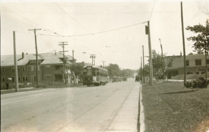
Car No. 1230 of the Rochester Subway heads north on Dewey Avenue, just passing Ridgeway Avenue, 1920s. The subway ran for nearly thirty years, beginning in 1927 until 1956.
Ridge Road looking east at Bonesteel Street. An advertisement for the Power Hotel can be seen to the right of center. This hotel was a Rochester staple, built in 1882 and located on West Main Street. Arnold Palmer celebrated receiving the 1960 Hickock Belt at the ceremonial banquet at the Powers.

Massive construction and upgrades took place in the 1980's for I-390, also known as "The Genesee Expressway." In Greece, this included a 4.6 mile extension of the expressway beyond Ridge Road to the Lake Ontario State Parkway. Formerly known as Rt 47, this photo shows the construction of bridge supports at English Road. The project cost $24 million and was completed in 1983.
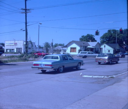
The corners of Ridge and Long Pond Roads looking east, 1970. The old Town Hall is visible in the center. Agostinelli's Super Market can be seen to the right. There were four Agostinelli's Fine Food Markets in Rochester at the time. Located at 2547 W Ridge Rd, as of 2020 it is the site of Heritage Jewelers.
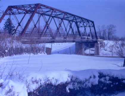
The old Elmgrove Road bridge over the canal, 1970. The bridge was permanently closed in 1970 and a new bridge opened in 1971.
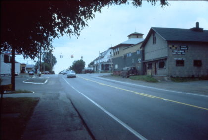
The corners of Latta and North Greece Road looking east in the early 1970's. The side of the North Greece Road Food Market is visible on the right. The DeMay Hotel can be seen across the street from the market.
Looking southwest, the corners of Maiden Lane and Long Pond Road, 1981. The J&J Corner Superette is seen on the left. Located at 1097 Long Pond Road, it was the seen of a 1976 robbery attempt in which the Greece Police Department used their police dog to capture two youths.
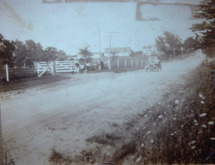
Latta Road in the early 20th century. At this time, it consisted mostly of large family farms. The Whelehan, Fleming and Kirk were just a few of the families holding at least a hundred acres along the road. By this time, the Latta family held 46 acres at the east end of the road.
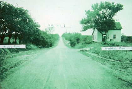
Old Eddy Road looking north toward Paddy Hill. The steeple of the Mother of Sorrows Church is visible in the distance. The name of the road was changed to Mt. Read Blvd in the 1920's. Frank Rigney was the proprietor of Rigney Farms. The Whelelan farm house was part of the Greece Historical Society "Tour of Historical Houses" in the 2000's.
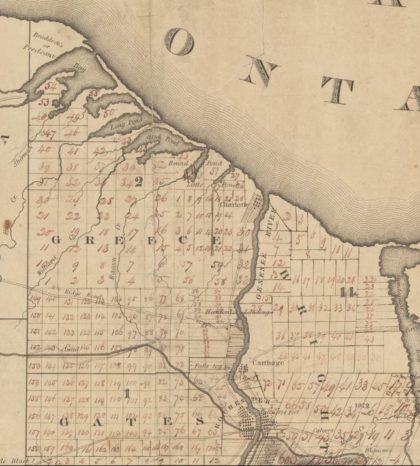
Map of Greece, 1820.