
Filter Results:
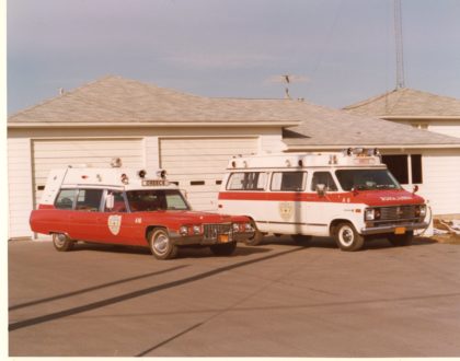
Greece Volunteer Ambulance vehicles, 1970's. Greece Volunteer Ambulance service began January 1, 1959 and received thirty six calls for service the first month of operation.
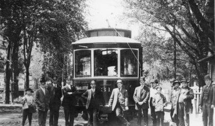
Manitou Trolley Car No. 31 ran from Charlotte to Manitou Beach, 1910's. The Manitou rail line delivered passengers to a number of summer hotel resorts along the shore of Lake Ontario. A lack of profitability and the increased popularity of the automobile contributed to the decline of the electric trolley and the Manitou Line ceased service in 1924.
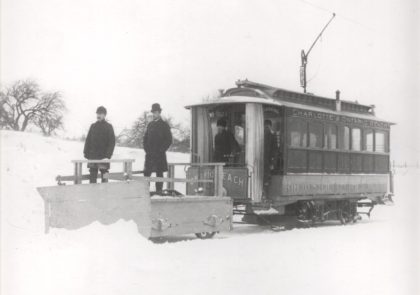
A Rochester Electric Railway track plow car, 1890's. The Rochester Electric Railway took over the Rochester City and Brighton Railroad and ran the first electric cars in Rochester.
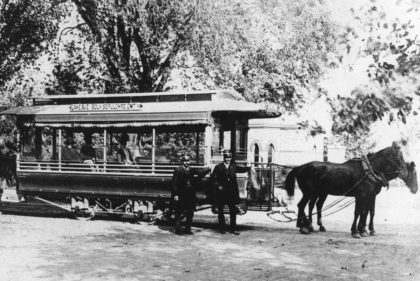
Horse drawn trolley, 1880's. This rail line was run by the Rochester City and Brighton Railroad Company and likely ran from downtown Rochester to Lake Avenue; ending at Holy Sepulchre Cemetery.
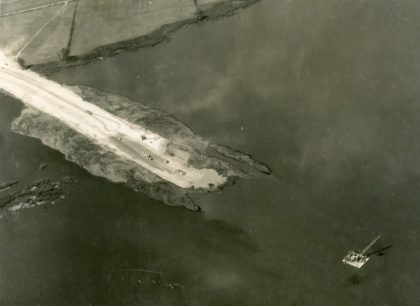
Construction of the expanded Lake Ontario State Parkway, 1940's. It was initially a two mile long gravel road building by the PWA in 1935 that ran through Hamlin Beach Park. The Parkway is now 35 miles long and runs along the shores of Lake Ontario. Initial funding was secured in 1937 and construction began in the 1940's. Additional extensions were added through the early 1970's.
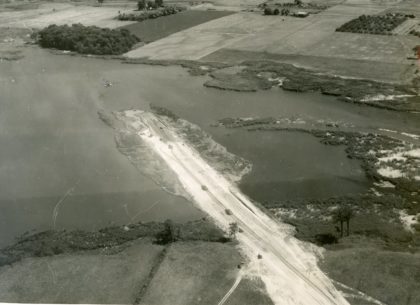
Construction of the expanded Lake Ontario State Parkway, 1940's. It was initially a two mile long gravel road building by the PWA in 1935 that ran through Hamlin Beach Park. The Parkway is now 35 miles long and runs along the shores of Lake Ontario. Initial funding was secured in 1937 and construction began in the 1940's. Additional extensions were added through the early 1970's.
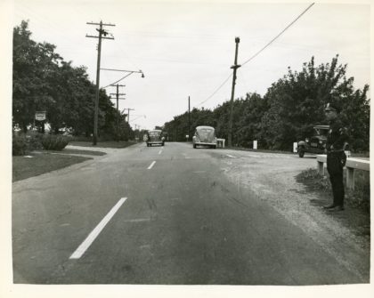
Ridge Road West and North Greece Road looking west, 1940's.
A view of Grange Hall on Ridge Road. The old Greece Town Hall can be seen to the far left. This Grange Hall was built in 1905 and torn down in the early 1960's and a new hall was built at 1301 Long Pond Road.
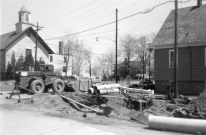
Road construction near Grange Hall, 1961. Greece Baptist Church is visible across Ridge Road. Grange Hall housed The National Grange of the Order of Patrons of Husbandry organization, which promoted community and agriculture in the area. This Grange Hall was built in 1905 and torn down in the early 1960's and a new hall was built at 1301 Long Pond Road.
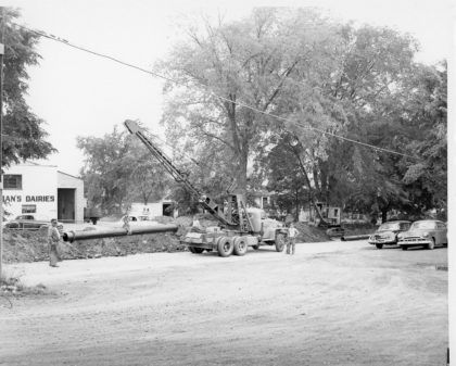
Drainage pipe installation along Long Pond Road, 1940's. Buckman's Dairies can be seen in the background.
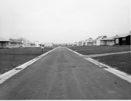
View of Woodcroft Drive, 1955. Woodcroft Drive is located east of Dewey Avenue and connects Rumson and Lawson Roads. Woodcroft Drive was part of a "building boom" that occurred in Greece during the 1950's. Between 1950 and 1955, the population went from 25,500 to 37,000. At that time, it was predicted to reach 90,000 by the mid 1970's.
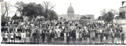
Students from Greece Archadia Middle School on class trip to Washington, D.C., 1999. The U.S. Capital building is in the background.
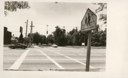
The corner of West Ridge Road and Hoover Drive looking south, 1980's. The Olive Garden Restaurant is now located on the right corner and a Holiday Inn Express is currently on the left corner.
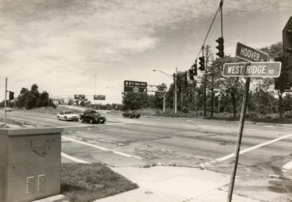
The corner of West Ridge Road and Hoover Drive looking north, 1980's. There is now a foot bridge over this intersection allowing for access to the Route 390 trail.
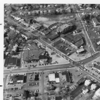
Aerial view of Dewey Avenue and Stone Road, 1970's. The Barnard School is visible in the upper middle of the photograph. The Dutch Mill Restaurant can be seen left of center.